The watch, which went into effect at 5:29 p.m. Sunday, has been issued by the National Weather Service for Southern Westchester.
A Tropical Storm Watch means tropical storm wind conditions are possible somewhere within the area and within the next 48 hours.
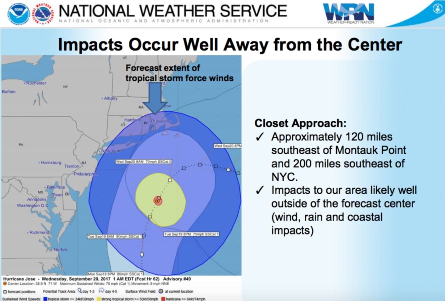
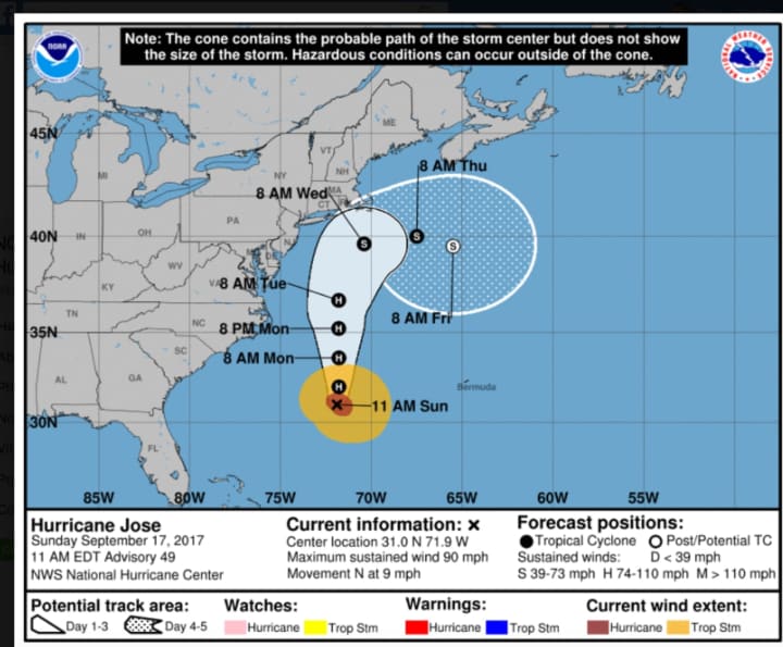
The eye of Jose is expected to be about 120 miles southeast of Montauk Point on the farthest point east on Long Island at about 1 a.m. Wednesday. (See chart above.) But Jose could impact Southern Westchester on Tuesday with rough surf at beaches, rain and wide and possible flooding in low-lying areas.
While no more than one inch of rainfall is expected for Jose, now a Category 1 hurricane, the Tropical Storm Watch warns of impacts from gusty winds.
Damage to porches, awnings, carports, sheds, and unanchored mobile homes is possible. Unsecured lightweight objects may be blown about and many large tree limbs broken off with few trees snapped or uprooted, but with greater numbers in places where trees are shallow rooted, said the National Weather Services.
Some fences and roadway signs may be blown over and a few roads may be impassable from debris, particularly within urban or heavily wooded places, the advisory also says.
Hazardous driving conditions on bridges and other elevated roadways and scattered power and communications outages are also possible.
For the latest National Weather Service briefing on Jose, click here.
Click here to follow Daily Voice Mount Pleasant and receive free news updates.